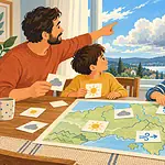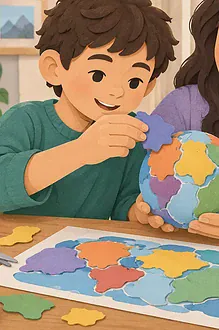


Coordinates turn a round world into a searchable grid. In this treasure game, children use latitude first and longitude second to narrow down mystery locations on a globe or world map. The emphasis is on reasoning from reference lines, not racing to memorise numbers.
What to prepare
- A globe, atlas or printed world map with latitude and longitude lines
- Small removable notes or counters
- Six to ten coordinate cards
- A reference card showing north, south, east and west
If your globe is delicate, place counters beside it rather than sticking anything on the surface. Digital maps are useful for checking, but start with a view where the coordinate grid is visible and children are not sharing a precise home location online.
Clarify the two measurements
Latitude measures how far north or south a place is from the Equator, which is 0° latitude. Lines of latitude run east–west around the globe but describe north–south position. Longitude measures position east or west of the prime meridian, which is 0° longitude. Lines of longitude meet at the poles.
A memory aid can help: latitude lines look like broad belts around Earth; longitude lines are long arcs from pole to pole. Treat the aid as a prompt, then return to the actual definitions.
Play the treasure round
- Begin with easy coordinates on major grid lines, such as 20° north, 30° east.
- Find the latitude line first and trace it around the globe.
- Find the longitude line second.
- Place a counter near their intersection and name the ocean, continent or region.
- Check with an atlas or digital coordinate display.
Coordinates identify a point, not an entire country. If the grid is coarse, the counter may only show an approximate area. Say “near” rather than claiming an exact city. Also note the N/S and E/W labels: leaving one out can move the treasure to a different hemisphere.
Build better clue cards
After several rounds, let children create clues. Each card should include latitude, longitude and an optional geographic hint: “south of the Equator,” “in an ocean,” or “near a mountain range.” Swap cards and explain the search aloud. Older players can use decimal degrees and discuss why negative numbers sometimes replace S and W.
Connect the grid with a room-map treasure hunt, where coordinates can be simplified to lettered rows and numbered columns. A contour-map activity adds elevation, and the water-cycle model encourages children to follow processes across regions.
Adapt the challenge
- Ages 6–9: use the Equator, prime meridian and multiples of 30 degrees.
- Ages 10–12: use 10-degree intervals and require hemisphere labels.
- Teenagers: compare degrees-minutes-seconds with decimal degrees and investigate rounding.
- Accessible play: add raised yarn along selected lines, use high-contrast tape, enlarge the grid or let one player describe while another locates.
Notice the limits
A coordinate is precise only when the measurement and notation are precise. A paper globe has thick printed lines; a rounded number covers an area; and map projections distort the curved Earth when displayed flat. The game teaches a geographic reference system, not surveying. Never use a child’s exact home coordinates as a public clue.
Try a coordinate error hunt
Prepare a few deliberately incomplete cards: one without a hemisphere, one with longitude first, and one with a value beyond 90° latitude. Ask players to diagnose the problem before touching the globe. This reveals whether they understand the system rather than following a routine. Correct the card together and explain why the repair works.
Finish by asking players to give directions in a complete sentence: “The point is 15 degrees south latitude and 45 degrees east longitude.” Then have them identify which reference line each number was measured from. That explanation is stronger evidence of understanding than a fast answer.